A high-pressure dome of hot, humid air is parked over the middle of the U.S. right now, driving temperatures up and heat indices up higher. But here in downtown Chicago, something weird happened this afternoon.
Around 1pm, a line of thunderstorms came down Lake Michigan from the north. Just before then, it was 33°C at O'Hare with a heat index close to 38°C. Then, within fifteen minutes, this happened:
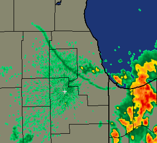
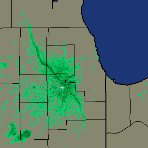
Note the green lin snaking from Gary, Ind., in the southeast around to Crystal Lake, Ill., in the northwest. That's an interface between cool air coming off the lake and the hot, muggy air surrounding it. And it's still raining there; here's the radar image from 3:50:
So right now, it's 25°C in Gary, 24°C in Lansing, Ill. (near Gary), and 33°C in Joliet (near the + sign on the radar images).
Weird. And welcome, at least in the Loop. But the temperature is climbing again as the thunderstorms make their way deeper into Indiana. And tomorrow's forecast predicts more humid heat. Bleah.