The Daily Parker

Politics, Weather, Photography, and the Dog

A glimmer...

We haven't seen the sun in Chicago since last Sunday afternoon. So after a full week of gloaming—with entire days of low instrument conditions—we finally have two little shards of potential relief. First, as happens almost every year on January 28th, the sun sets tonight at 5pm for the first time since we changed the clocks in November.

And then this morning, we finally have the phrase "Mostly sunny" in the weather forecast for tomorrow.

We can only hope.

Update: The Guardian worries that all the clouds and gloom will affect our mental health. Nah. We're alllll fiiiine here...

Update: This is what dreary weather looks like in three charts:

El Niño plays with the excess energy

We talk about anthropogenic climate change in human-centric terms: the planet is getting warmer very quickly relative to the historical baseline of 1800 CE. But heat just means energy. A plane flying from Taipei to Los Angeles got some kinetic energy from the warmer Pacific waters this week:

China Airlines Flight 5116 rocketed to a speed of 1,329 km/h as it bolted eastward across the Pacific Ocean on Thursday, potentially breaking informal records for passenger travel. The commercial flight, which departed from Taipei, landed more than an hour early in Los Angeles, propelled by exceptionally strong tailwinds.

A roaring Pacific jet stream, supercharged by the El Niño climate pattern and moving at more than 400 km/h, gave the flight a boost.

China Airlines 5116 flew its route of 11,593 km in just 10 hours 18 minutes, which rounds to an average speed of 1,126 km/h! That’s including takeoff, landing and all the slower points in the journey. (Working against the jet stream, an average westbound flight from Los Angeles to Taipei is usually scheduled for 14 hours 40 minutes.)

That wasn't the only record: Washington DC hit 27°C on Friday, the warmest temperature ever observed there in January.

Unfortunately the same hemispheric weather system making planes go fast and giving the East Coast June-like weather has kept most of the central US in thick fog:

Since Tuesday, record amounts of fog have blanketed the Lower 48 states, lowering visibility, disrupting flights, causing vehicle accidents and even delaying schools.

On Thursday morning, dense fog advisories affected nearly a third of the United States population (more than 100 million people) and parts of 27 states. These advisories covered the entirety of Iowa, Missouri, Louisiana, Mississippi, Illinois, Indiana and Tennessee and portions of many other states from Texas to New York.

Advection fog is the cause. Unlike radiation fog, which typically forms overnight when skies are clear and winds are calm in the spring and fall, advection fog develops when warm, moist air is transported over a layer of cold air near the ground.

Tuesday, Wednesday and Thursday mornings set records for the number of dense fog advisories nationally, according to Daryl Herzmann, a systems analyst who manages a weather hazard database at Iowa State University. Each day surpassed the record set the day before. The fog advisory database dates back to January 2005.

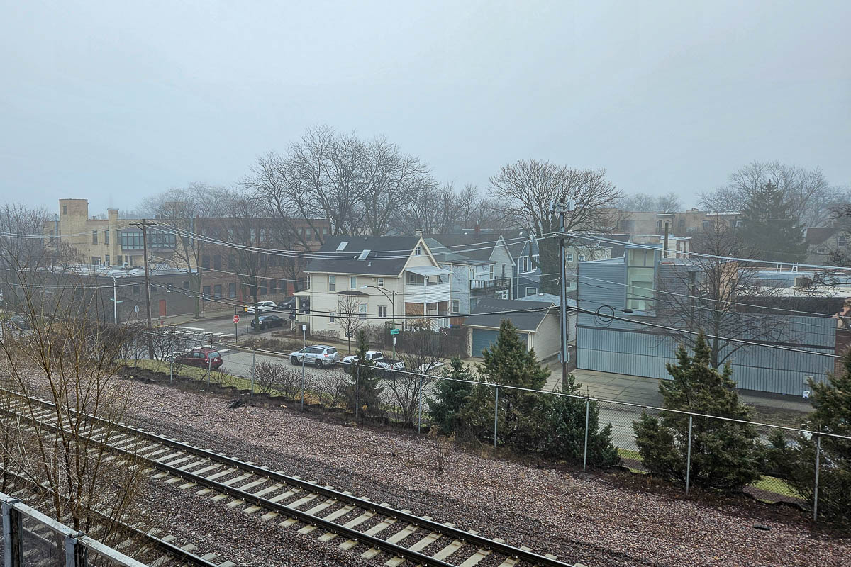
I can confirm it is still foggy in Chicago:

Update: This is all quite a change from 10 years ago today, when the polar vortex visited Chicago with -31°C wind chills.

You don't need sunscreen in Chicago in January

A weather pattern has set up shop near Chicago that threatens to occlude the sun for the next week, in exchange for temperatures approaching 15°C the first weekend of February. We've already had 43 days with above-normal temperatures this winter, and just 12 below normal during the cold snap from January 13th through the 22nd. By February 2nd, 84% of our days will have had above-normal temperatures since December 1st.

Thank you, El Niño. Though I'm not sure the gloominess is a fair exchange for it.

Elsewhere:

Finally, Minnesota-based wildlife photographer Benjamin Olson discovered that a mouse had moved into his car. So naturally, he set up a photo trap. And naturally, it's totes adorbs.

Slick moves walking the dog

Walking Cassie to day camp took a lot longer than usual this morning because the freezing rain and near-freezing temperatures after a long cold snap laid a layer of ice over nearly every sidewalk and street in Chicago. She seemed very concerned about my ability to walk, and very disappointed that we didn't take our usual detour to the bagel place to get me some coffee and her a fresh dog treat.

The "wintry mix" has stopped and the temperature has risen all the way to 1.5°C at Inner Drive Technology World HQ, so the walk home may not suck as much as the walk there.

Meanwhile, in the rest of the world:

Finally, we might have gotten to Peak Rat Hole. Residents of the 1900 block of West Roscoe have gotten fed up with all the people coming to see the 30-year-old dead squirrel impression on their sidewalk. Perhaps the wedding took things too far?

Cold snapped

Around 7 this morning, the official Chicago temperature at O'Hare went above -15°C for the first time in 81 hours, the longest such cold snap since February 1996:

In the 1996 stretch, O’Hare recorded highs of -20.6°C on Feb. 2 and 3, and of -16.7°C on Feb. 4, according to NWS meteorologist Casey Sullivan.

Sullivan said the longest stretch of temps below -15°C in the area was a period of five days in the 1880s, according to NWS records, which go back to 1871.

“It doesn’t look like we’re going to do that, but it’s unusual, not unheard of,” Sullivan said of the cold streak.

There may be some — albeit slight — relief from the extreme cold on the way in the coming days. High temperatures Wednesday should climb to a high of around -8°C, the NWS said.

Thursday’s high temps could end up near -5°C, and Friday’s high is expected to be near -9°C.

As of 1pm we've gotten up to -9°C, but the sun is out, and we have brisk west-southwest winds, both of which should help. As long as it stays above -10°C I can walk Cassie home from day camp. (I had to drive her yesterday and today.)

The National Climate Prediction Center says the Arctic Vortex will get back to where it once belonged next week:

I sure hope so. And if Cassie understood "future" as a concept, so would she.

Still chilly, but not like 1985

My socials today have a lot of chatter about the weather, understandably as we're now in our fourth day below -15°C. And yet I have vivid memories of 20 January 1985 when we hit the coldest temperature ever recorded in Chicago, -32°C. The fact that winters have gotten noticeably milder since the 1970s doesn't really matter during our annual Arctic blast. Sure, we had the coldest winter ever just 10 years ago, but the 3rd and 5th coldest were 1977-78 and 1978-79, respectively. I remember the snow coming up to my chin those years, and the never-ending below-freezing temperatures (like the 43 days from 28 December 1976 to 8 February 1977).

That said, I completely support the Chicago Public Schools closing today and tomorrow. And that they smoothed out all the streets since I was younger, so kids don't have to walk uphill both ways in the snow. But given the wind-chill advisory in effect until tomorrow morning, none of us wanted to go into the office either.

So instead of commuting, I'll have some time to read these as I shiver in my home office:

Finally, should I get an induction burner? I've been using my electric teakettle to pre-boil water for pasta, which saves a ton of time. The Post looked into the benefits of induction vs natural gas, principally around air quality. Looks like it's worth $120 to reduce my gas use. Of course, since I have gas furnaces, it might not do a lot for me this week.

Chilling at home

Our company has Martin Luther King, Jr. Day off, which will allow me to get a bit of rest after my lightning trip to Seattle. And to celebrate, I've broken out the Arran sweater and long-johns, because wow is it cold:

The National Weather Service reported extreme cold and a wind chill of minus 40 in Aurora on Sunday morning and issued a wind chill warning through noon Monday.

Weather service senior meteorologist Brett Borchardt said Chicago narrowly missed breaking the record — 1 degree — for the lowest maximum temperature for Jan. 14. The temperature at O’Hare was 3 degrees “for a few minutes” after midnight Sunday before falling below zero, he said.

“But the air temperature has been below zero [Fahrenheit] during daylight hours today, so I would call that unusual,” Borchardt said.

Sunday night’s low of minus 15 will be the coldest since the polar vortex of 2019.

The official low yesterday was -23.3°C. At last report O'Hare had -22.2°C with a wind chill of -32.3°C, while IDTWHQ reported -19.1°C.

Walking down the jet bridge from the plane to the terminal at O'Hare gave me just a little taste of the cold; walking Cassie this morning gave both of us a full serving. She lasted 4 minutes before pulling towards the house. I don't think she'll get her usual hour of walkies today, and I don't expect to get my usual 11,000 steps. But it should get much warmer on Wednesday—maybe even up to -8°C! So we might get them later in the week.

Now to offload all the crap that accumulated on my phone over the week...

Too short and too cold

I'm watching my plane arriving from Chicago to get all of us going back there on it, a little remorseful that I couldn't spend more time in Seattle. I last visited in 2013 to watch the Cubs hold their own against the Mariners for 9 whole innings, only to lose with no outs in the bottom of the 10th. On that June day Seattle had sunny 30°C weather. This morning we had sunny weather, I'll give it that:

But warm? No. In the 38 hours of my trip it only got above -6°C once I got to the airport to go home.

I'll be back this spring. I'll even stay longer than two days.

Meanwhile, Cassio got to play a Casio. I hope she's doing her finger exercises:

I look forward to a recital when I get home in a few hours.